

G A L L E R Y


 |
Home
Image
List by Species |
- FOR AN ENLARGED VIEW SIMPLY CLICK ON EACH IMAGE -
TO RETURN, PRESS THE BACK BUTTON ON YOUR BROWSER
Please note: These images are merely thumbnails, so that they are easily downloadable
and do not represent the quality of the originals in any way.
* Copyrights Apply *
IMAGES OF ATTU ISLAND
A BIRDING PARADISE
IT WILL NEVER BE DUPLICATED AGAIN
BY OUR 3 WEEK TRIPS
No matter how much others may wish or try
ALL IMAGES ON THIS PAGE ARE COPYRIGHTED AND
NOT FOR USE BY ANYONE WITHOUT MY EXPRESS PERMISSION
Unfortunately those folks going out to Attu for just a few days and not living
in the conditions
we slept, ate, and rested in will never have the full experience we did.
Much different
when you cover a great deal more areas and experience spots like Temnac Valley!
A good you tube video of Attu to give you a flavor of what we went thru
for 3 weeks every spring on the island:
https://www.youtube.com/watch?v=inFjuB2MIR4
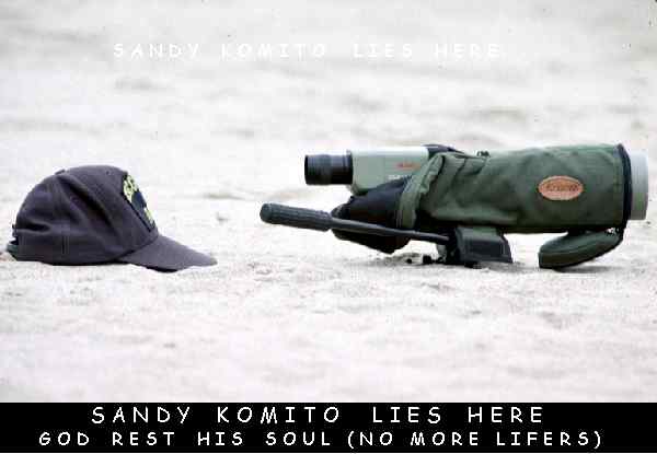
While observing the Little Curlew in Santa Maria, CA
Sandy Komito took the wrong step trying to get a
better LooK - he fell into quick-sand and the
other birders couldn't help him for all they
saw were his LOUD PLAID PANTS !!
(Sandy's hat and scope all left - Aug, 1993)
Those who spent our 3 weeks on Attu each
year 'understand' the above comment!
on a more serious note.....
Attu - the name yields many
special thoughts for those who have been there,
and a mystery and a sense of anticipation for those who haven't ! Attu is the
westernmost island of the Aleutians, nearly 2000 miles west of Anchorage and
the westernmost point in North America causing the International Date Line to
make a big jag to the west. The island is much larger than most think being
approximately 35 miles long. Attu however, is approximately the same latitude
as Seattle, WA but with much different weather! It's a beautiful place, which
is an understatement, and yields some of North Americas most rarest birds -
and many First NA Records!! Although beautiful, the 'remains' of WWII still
abound, with oil drums (still leaking oil from the time of the war), and heavy
equipment left to rust on the hillsides and in the ocean. It is a rugged island
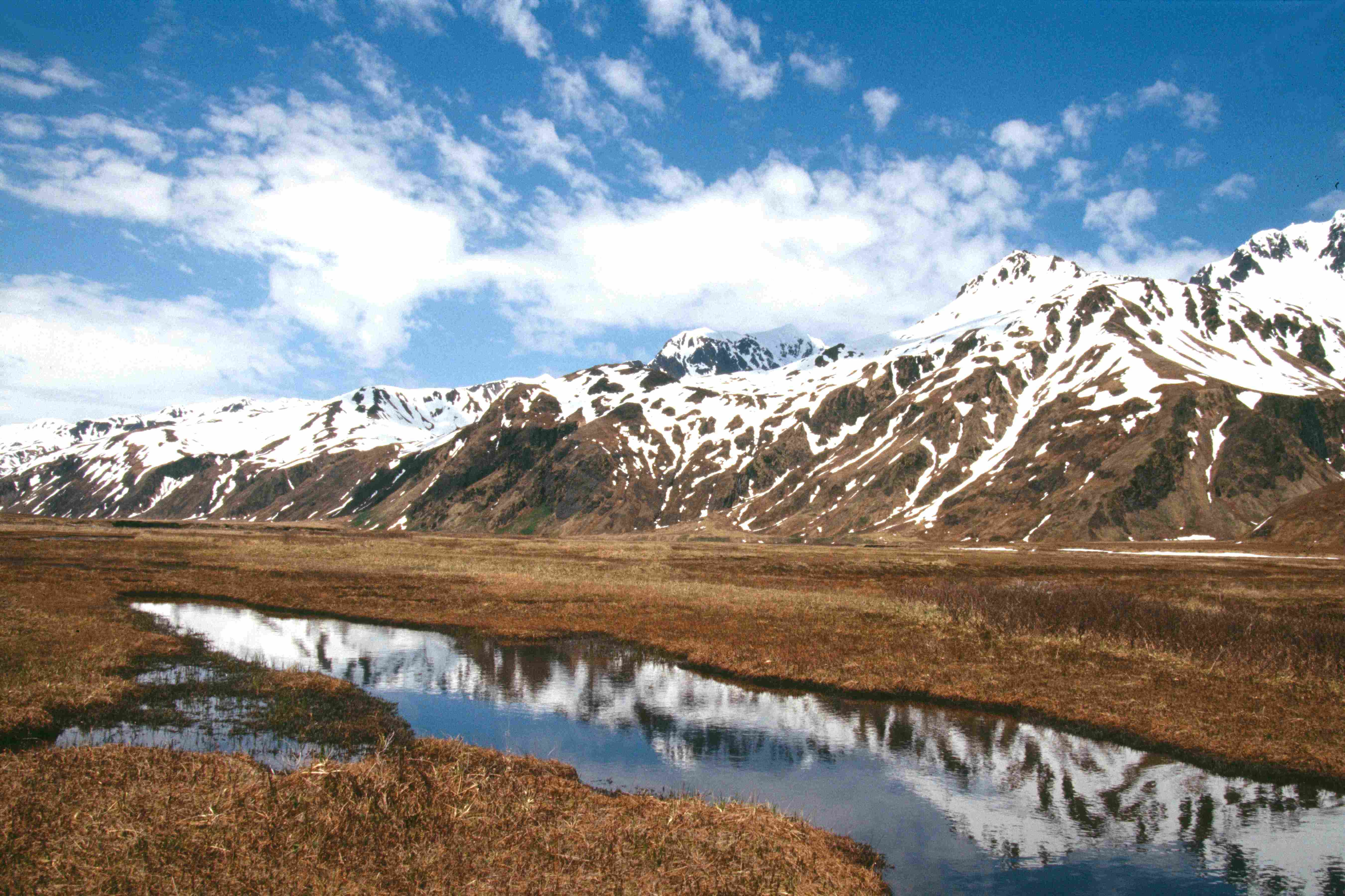
with beautiful snow covered mountains, and a hike or bike ride anywhere will
yield fabulous views albeit sore bodies. Mixed with snow, sleet, rain, and
wind, any of the aforementioned elements in any order, not to mention the
cold, will challenge even the heartiest of souls. However, the birds that the
folks who venture to this remote place on earth for can be
MOST REWARDING !!!
Some even come here just for the "experience".
Follow me on an 'adventure' tour of the sights of Attu. Although you may see
many of the bird species found at Attu in the accompanying galleries
(BACK on your browser)
we have left this gallery page as a scenic tour of a visit to this majestic place.
On this map Attu is shown as "Navy Town, Alaska"
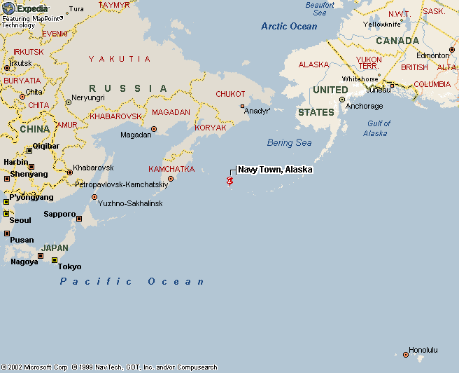
On this map Attu is shown as "Navy Town, Alaska":
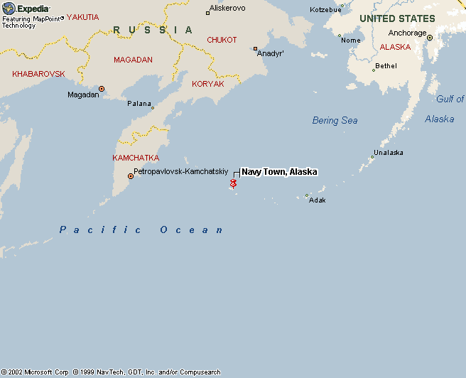
On this map Attu is shown as "Navy Town, Alaska"
Gives you a 'feel' of how far out from Anchorage
and the Aleutian Islands it is
far western most island is Attu
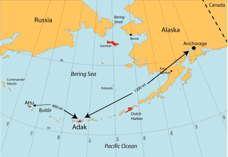
distances in the Aleutians
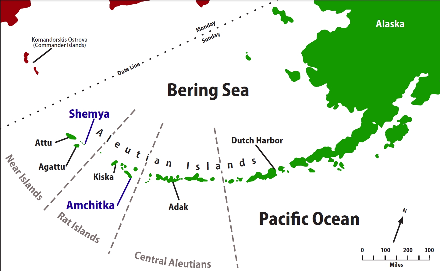
ISLANDS GOING WEST TO EAST TOWARD ANCHORAGE
Beginning with Attu Island here are the next few islands

Attu Island (35 mi x 20 mi) - this is the furthest West in the United States and
last western most Aleutian Island
moving eastward along the Aleutian Island chain
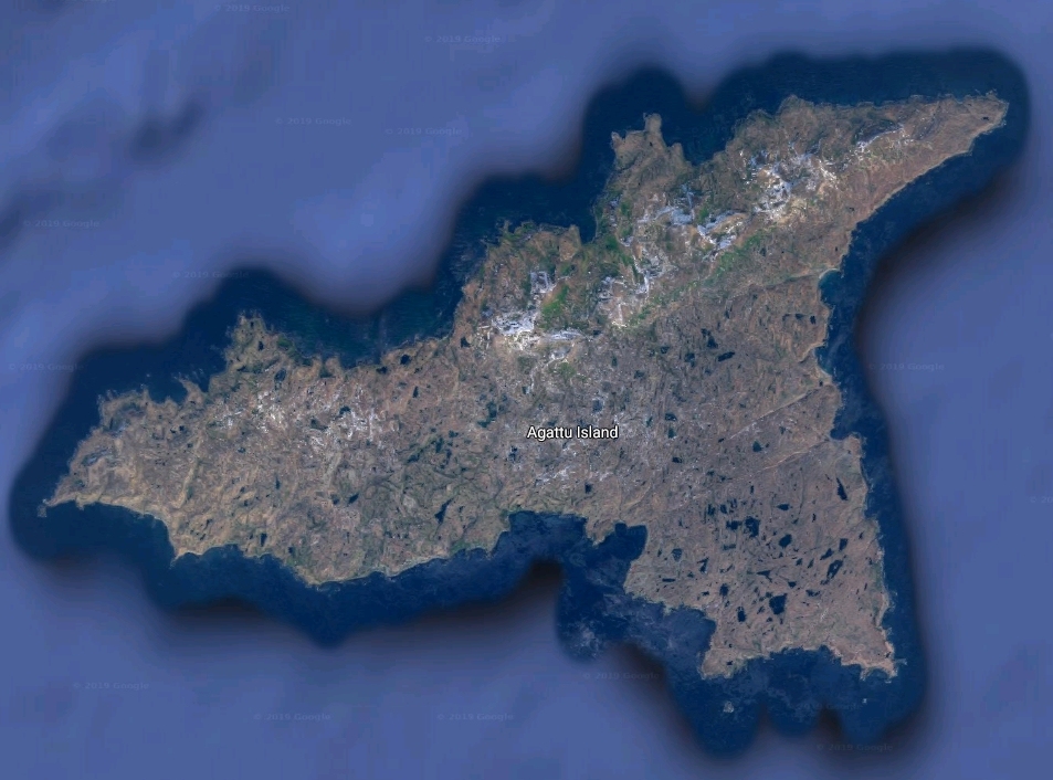
then Agattu Island
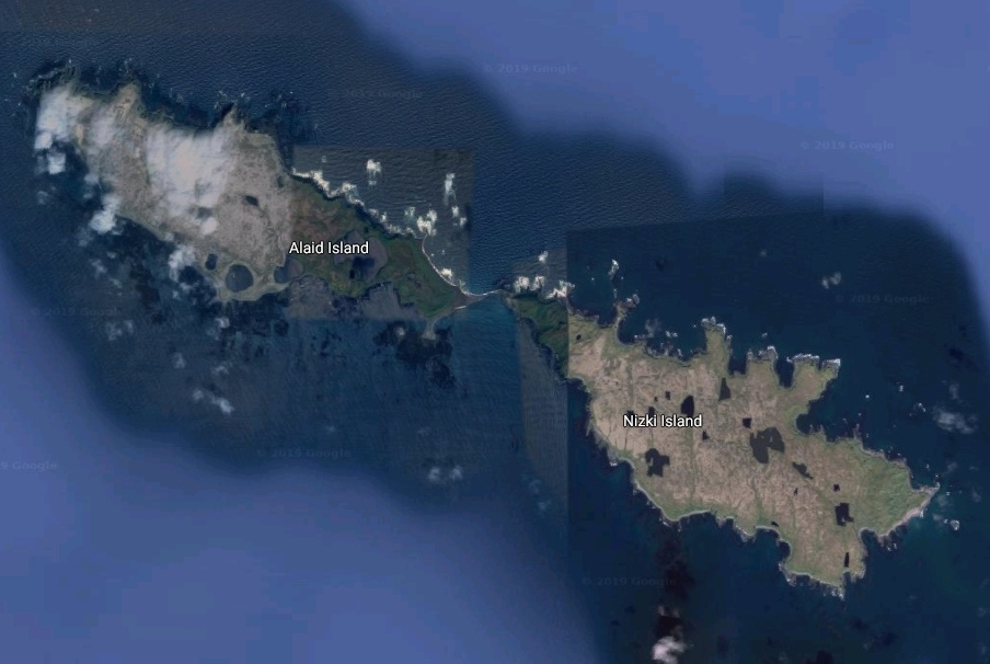
then Alaid Island & Nizki Island
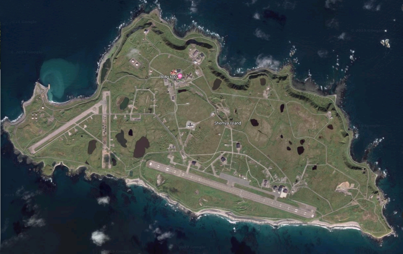
then Shemya Island
then on to Anchorage
On Attu Island
Where is Attu? The
furthermost Aleutian Island from the mainland
and less than 250 miles from the Siberian coastline and
nearly 2,000 miles west of Anchorage.

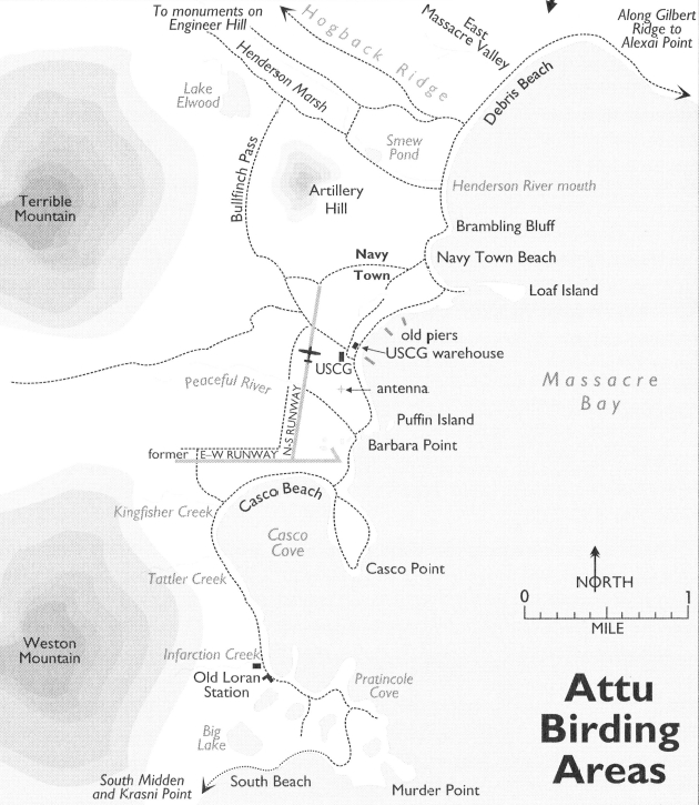
A map of Attu Island birding areas - specifically the area covered in the
following images extending from the lower left corner (base camp)
although we went further west to Temnac Valley and to
Murder Mountain areas to bird (not shown on map)
to the lower right corner (Alexai Point).
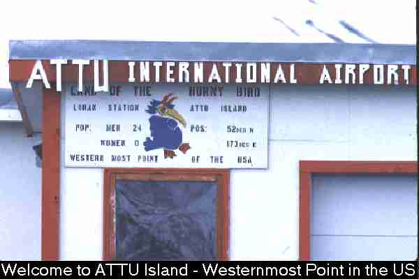
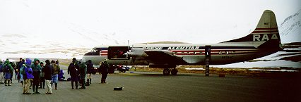
Welcome to ATTU Island - A Birder's Paradise!
This is the first thing you'll see getting off the
Reever (Reeve Aleutian Airways) aside
from the pristine beauty of the island!!
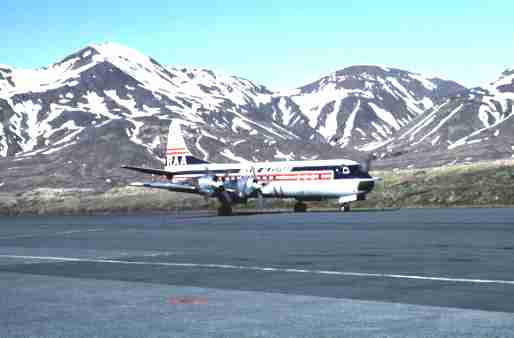
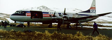
Arriving at Attu on the infamous Reever. The Reeve
Aleutian Airway pilots are some of the best in the world
and they prove it everyday in the Arctic/Aleutian weather.
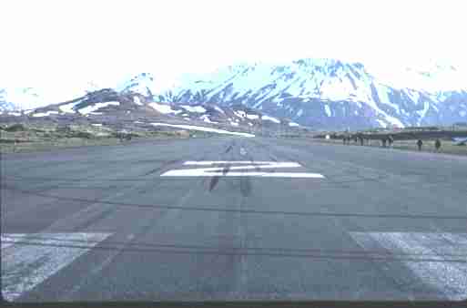
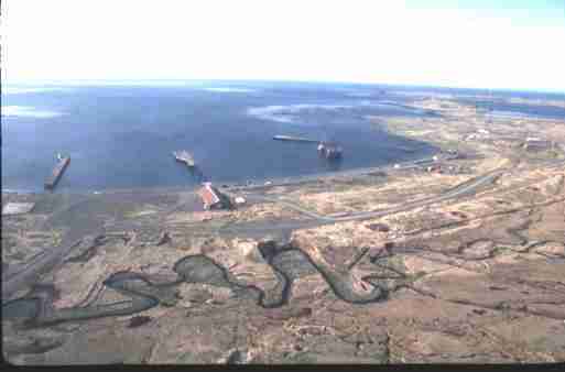
Attu International runway! On a trip back to base it is a welcome
relief to ride on hard pavement (the only place on the island) and it
is downhill for over 6000 feet. When heading out from base camp
for a bird and struggling a headwind, even pavement seems a chore!
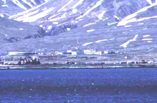
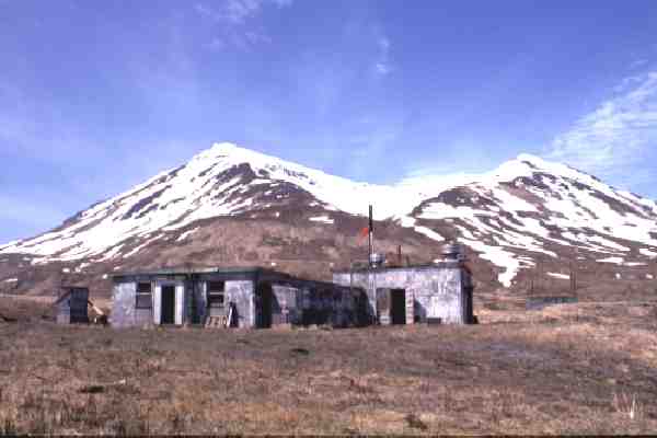
US Coast Guard - Loran Station (LORSTA)
The 25, give or take a couple, Coast Guard personnel attend this
Loran station - which affords the lucky birders the luxury of coming
to this island to bird. With the advent of GPS it may be history soon.
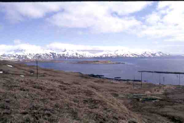
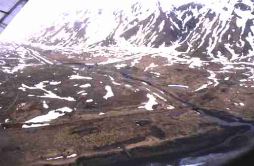
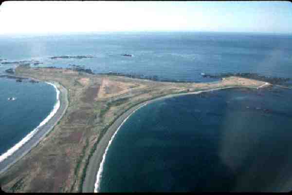
Looking out over Casco Cove w/Gilbert Ridge in the background.
Casco Cove is the sight you see from the 'lower base' (quarters).
Gilbert Ridge (on the right side) extends out to Alexai and it is an
approximate ten mile journey from camp to Alexai!

A view back toward base camp - at the left-hand foot of
the mountain with a view of Navy Town.
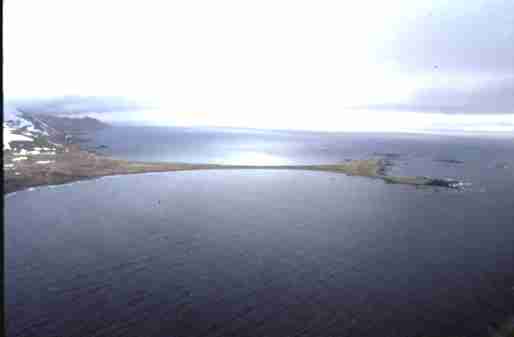
'Warehouse' beach. Looking back from Massacre Valley
toward the base camp. At one time this was the Navys'
ship docks for supplies but the piers are barely standing today.
Another view of 'Warehouse' beach with a little sight of the
expected terrain while trying to 'chase' that life bird!
The mouth of the Peaceful River - an oxymoron for what
occured during the war but a beautiful river and valley. The
fishing here will feed over 60 people with only two fisherman
fishing for a few hours! Bring your fishing poles!
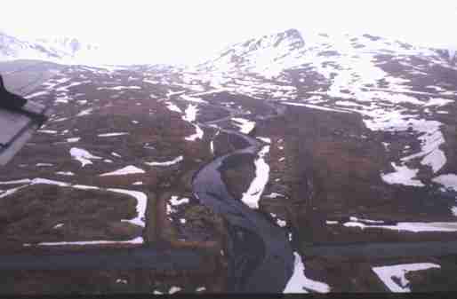
East Massacre Valley. Beyond the runway and heading to
Gilbert Ridge and Alexai this is a beautiful valley with a tragic
history as the name implies.
Gilbert Ridge with its not so 'perfect' trail, extends along from
East Massacre Valley toward Alexai Point. It's an arduous ride/
walk along it but yields beautiful waterfalls and scenery.
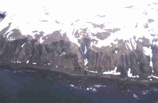
Alexai Point! Usually the furthest point one travels while heading
east for a day of birding. It has yielded many a life bird and is a
beautiful place to relax with your lunch.
The furthermost tip of Alexai Point. An arduous walk (no bikes)
from the base of Alexai but many a good bird like Spectacled Eider
and Bean Goose have been seen here.
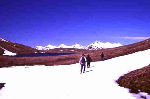
For the 'strong' and adventurous, there's the hike to Temnac Valley
(a magical place) to see the famed Attu White-tailed Eagle !
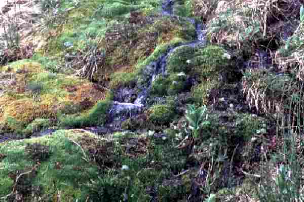
What the terrain looks like - a running stream w/lichen moss
and tundra when you're not walking on snow..
Temnac Valley (my personal favorite place on Attu) - Attu Island, Alaska
If you are up to a full day's hike over snow covered mountains
and a raging creek, the sight you behold while entering this valley
almost (I said almost!) makes you forget you came here to see the
White-tailed Eagle. To many, this is the most beautiful place on Earth.
Lower Base - where we reside! Who promised Marriott?
Although looks can be deceiving, it's pretty much what you
see however the Attour staff has made it quite livable - for
Attu and birding standards!!
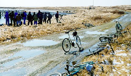
Birding by Bike - Attu Island, Alaska
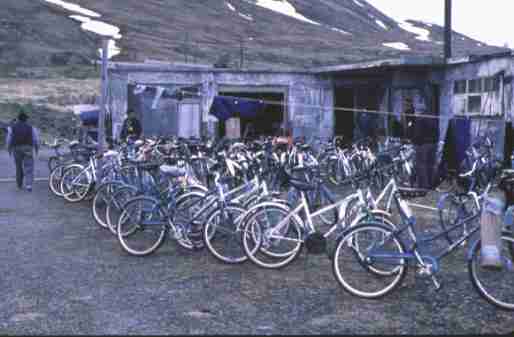
Lower Base with bicycles (in the days of 3 speed bikes - later finally
multi-speed mountain bikes), Attu Island, Alaska
The 'formal' mode of transportation! Although early birders
to the island walked, they then 'graduated' to 3 speed bikes.
Today, most are 20+ speed mountain bikes - but the terrain
can still test the strength of your legs. Many come back with
leg muscles hard as a rock!
Larry Balch standing w/ Coffee Cup near left of photo
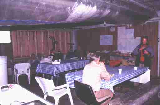
The 'Day Room" at the "Hilton". Although the weather at Attu can be pretty bad,
only a couple of days are usually spent staying 'home'. Quite a few
'stories' have been told here and a lot of mean Gin Rummy games!
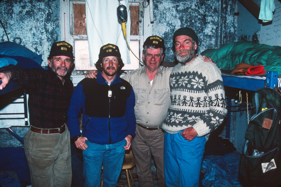
Attu,
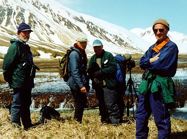
Spring 1991 - a few years ago (Me - Second from left in Blue Jacket)
Just 'hangin' out in the day room
David Narins, me, and the infamous Sandy Komito !
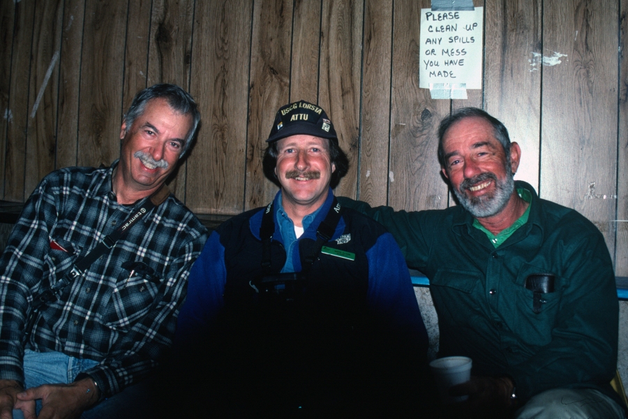
Spring 1993
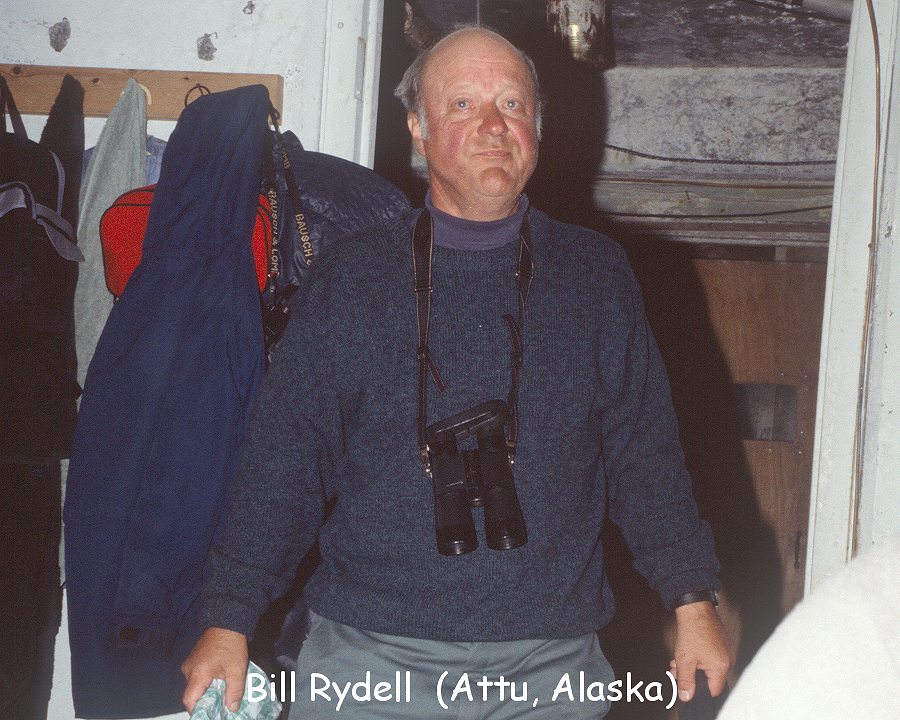
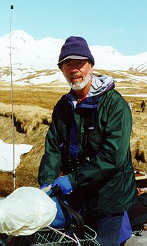
Dr. William "Bill" Rydell, Attu Island in 1991 - one of the first birders to do a big
year breaking 700 species
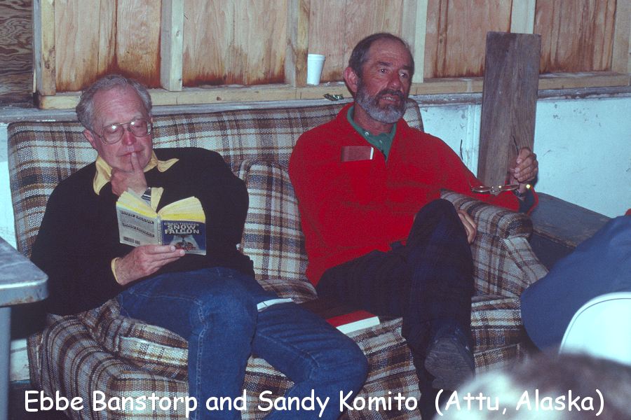
Ebbe Banstorp (my
lifetime travel companion chasing birds) of California (and since moved back to
his homeland Sweden,
and Sandy Komito of New Jersey (now residing in Florida) in 1991
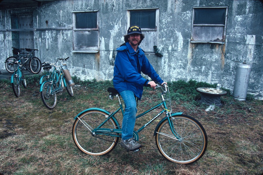
Me on my bike - Attu Island, Alaska
BJ Rose from Sedalia, Missouri at Attu, Alaska circa early 1990's
Was #1 Photographed Bird Species in the ABA for decades
and now retired and enjoying his dog, Patches
(and my life long buddy!)
BJ passed away June 6th, 2019 and will be very sorely missed
as I feel a huge void in my life and soul now.
I will see you in heaven BJ.

The walk to 'Upper Base' for meals is a welcome journey.
Although remote, the Attour staff serves fantastic meals that
really hits the spot after a tough day out in the field.
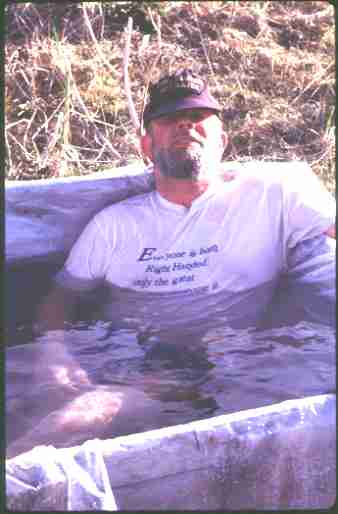
Al Driscoll taking in the Hot Tub ! Yeah, on the one sunny day
the hot tub goes up ! It's a welcome relief after a 'tough' day of birding!
Al Driscoll - Attu Island, Alaska
Sandy Komito (left) - Attu Island, Alaska
Sandy Komito - Attu Island, Alaska
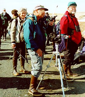
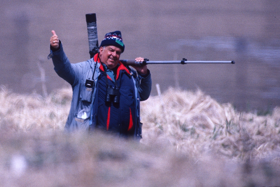
Jerry Rosenband - Attu Island, Alaska
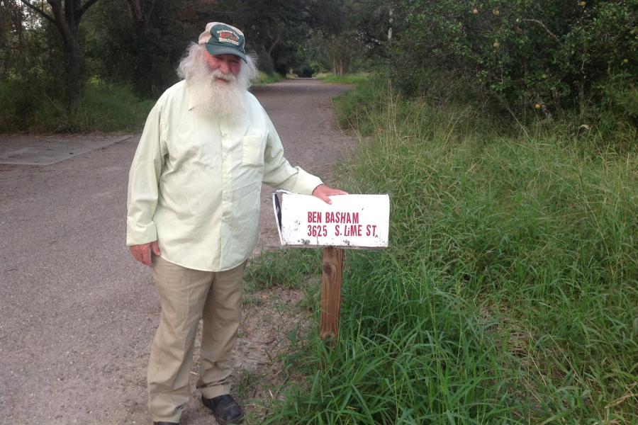
Benton Basham - years later after many trips to Attu
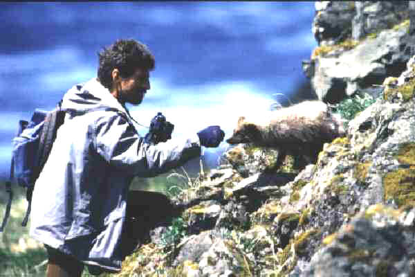
Gettin' friendly with the islands Arctic Fox a participant
attempts to make friends.
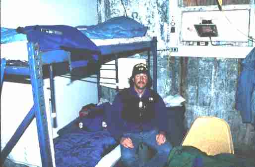
The author in his 'humble abode' !! We call it the Hilton,
although it lacks a few (a slight few lol) of the amenities !!
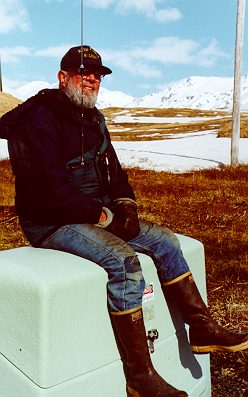
Waiting to go back to Anchorage - Attu Island, Alaska
Waiting to go back to Anchorage - Attu Island, Alaska
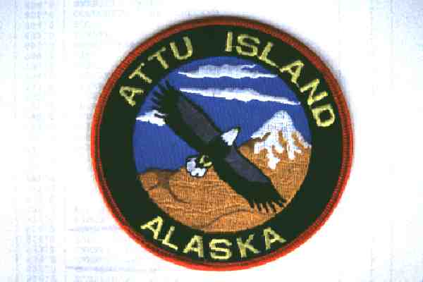
Attu Island Birding Patch
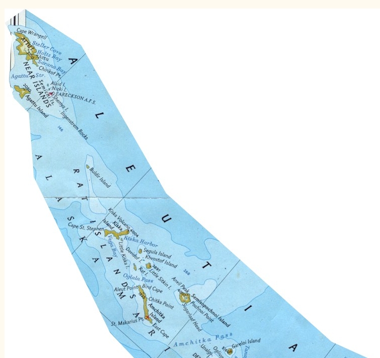
Attu Island - last (westernmost) Island in the Aleutian Islands - nearly 2,000
miles west of Anchorage, AK
Attu Island is the most remote, most westward island in Alaska’s Aleutian chain.
Lying at 538N, 1738E, the island is situated with Anchorage, Alaska, 1920 km to
the
northeast and the city of Petropavlovsk on the lower Kamchatka Peninsula of
Russia
nearly 960 km to the west. The island is 67 km long and 26 km across at its
widest
point and includes approximately 400 km2 of land area dominated by high
mountains
and largely inaccessible wilderness area. The only roads and habitation are in
the southeast corner of the island where there is a small coast guard station
and
runway and a rudimentary road system left over from an abandoned military base.
Attu Island has three major claims to fame: 1) its generally miserable weather,
2)
the bloody battle fought by U.S. troops in 1943 to recapture the island in World
War II, and 3) the remarkably rich mix of Eurasian bird species that can be
found
on the island during spring (and fall) migration.
Relatively little was known about Attu’s avian population until the mid-1960s
when systematic
inventorying of Alaska’s natural resources was undertaken in preparation for the
creation
of a series of
new national parks and wildlife refuges throughout the state. Based on
information from these early studies, Lawrence Balch (subsequently president of
the American Birding Association) visited Attu in 1977 with two friends to cover
the spring migration. The trip proved so successful that he began helping others
to
visit the island and in 1979 began running organized birding trips to the
island.
By1980 the group size had grown to 50–80 participants (the maximum that could be
handled at the rudimentary facilities available on the island) and remained at
those
levels throughout the following 20 years.
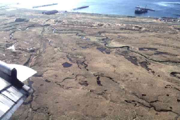
Field observations during this period focused on an approximately 64 km2 area
in the southeastern corner of the island known as Massacre Valley. The area is
occupied by a Loran C Coast Guard station and a former military airbase and is
bounded on the east and south by the Pacific Ocean and on the north and west by
ridges and mountains backed up by the Bering Sea. The former military base
included two main runways oriented north–south and east–west along with a series
of taxiways and paved maintenance and parking areas. During the 1940s and 1950s
several hundred support buildings were built in the area but most of these have
either collapsed or been torn down, leaving little more than the extensive but
badly
eroded network of roads to mark where the buildings had been.
In very large measure this system of roads and runways proved to be the key to
success to bird observation activities at Attu. Massacre Valley offered a wide
range
of habitats including extensive salt and freshwater marshes, streams and lakes,
thick chest-high brush, and in protected areas dense thickets, but the combined
vegetation, water, and omnipresent mud made off-road bushwhacking generally
difficult. In the upland areas along the ridges and mountains, the off-road
terrain
was reasonably dry but tended to be relatively steep, rocky, and sometimes
unstable.
To add to the risks of off-road travel, a number of off-road areas both in the
valley and at higher elevations had been declared off-limits because of possible
live
ammunition and/or other hazardous materials left over from the 1940s and 1950s.
Under these circumstances the compact network of roads and runways provided
a permanently fixed infrastructure for facilitating consistent and systematic
observer
coverage of the area both on a day-by-day and year-by-year basis. Each day
during the annual count period participants split up into four to six teams with
each
team assigned to cover a predetermined section of the road/runway network and
associated areas.
The basic function of each team was to seek out, identify, and
count all but the most common species found in its assigned sector with
particular
emphasis on Asian species, since these were the species of most interest to many
of
the Attu observers. Each team leader was given a citizens band (CB) radio to
report
the team’s observations back to base camp on a half-hour basis as well as to
communicate with nearby teams about potentially redundant observations. Teams
were generally in the field, on bicycle and/or foot, for eight hours or more per
day.
At the end of each day, the teams met to review the count data, identify and
resolve
any questionable observations and redundancies, and compile a total count for
the
entire count area of the numbers of individuals of each species seen that day.
The story of the capture and
take-back of the Aleutian Islands of Attu and Kiska during World War II
is not well-known to most Americans, and few veterans of the fierce
three-week-long
battle on Attu in May 1943 remain to tell their stories.
The battle ended in the death of nearly 3,000 Japanese and 529 Americans.
Some more to come !! Hope
you enjoyed your stay !!
ALL IMAGES ON THIS PAGE ARE COPYRIGHTED AND
NOT FOR USE BY ANYONE WITHOUT MY EXPRESS PERMISSION
|
HomeImage
List by Species |
- FOR AN ENLARGED VIEW SIMPLY CLICK ON EACH IMAGE -
TO RETURN, PRESS THE BACK BUTTON ON YOUR BROWSER
Copyright
©
1996-2025
Monte M. Taylor / All Rights Reserved. 36 USC 380
The Contents and Graphics were created by and copyright owned by Monte M.
Taylor and protected
by U.S. copyright laws. The Contents and Graphics may NOT be used on another
website,
for email attachments, chat sessions, clipart collections, or by any other
means, including copying or saving of digital image files, unless
otherwise expressly written permission was granted by me.