

G A L L E R Y


 |
Home
Image
List by Species |
- FOR AN ENLARGED VIEW SIMPLY CLICK ON EACH IMAGE -
TO RETURN, PRESS THE BACK BUTTON ON YOUR BROWSER
Please note: These images are merely thumbnails, so that they are easily downloadable
and do not represent the quality of the originals in any way.
* Copyrights Apply *
ALL IMAGES ON THIS PAGE ARE COPYRIGHTED AND
NOT FOR USE BY ANYONE WITHOUT MY EXPRESS PERMISSION
IMAGES OF ATTU ISLAND
A BIRDING PARADISE
IT WILL NEVER BE DUPLICATED AGAIN
BY OUR 3 WEEK TRIPS
No matter how much others may wish or try
Unfortunately those folks going out to Attu for just a few days and not living
in the conditions
we slept, ate, and rested in will never have the full experience we did.
Much different
when you cover a great deal more areas and experience spots like Temnac Valley!
A good you tube video of Attu to give you a flavor of what we went thru
for 3 weeks every spring on the island:
https://www.youtube.com/watch?v=inFjuB2MIR4
you may have to copy and paste this URL above into your browser as at times it
says it won't connect
This is a great 1 hour 38 minute video of Anchorage to Attu and on the island
itself
Now for the pics
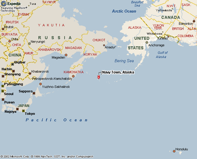
On this map Attu is shown as "Navy Town, Alaska"
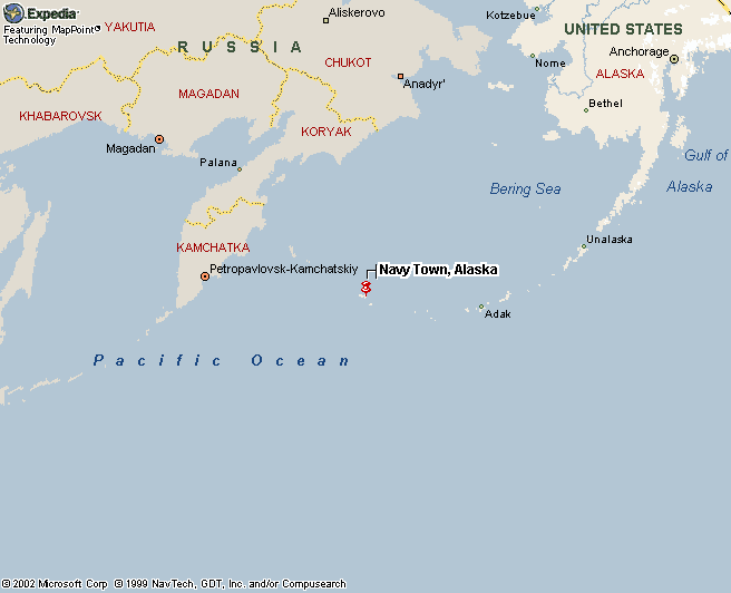
On this map Attu is shown as "Navy Town, Alaska"
Gives you a 'feel' of how far out from Anchorage
and the Aleutian Islands it is
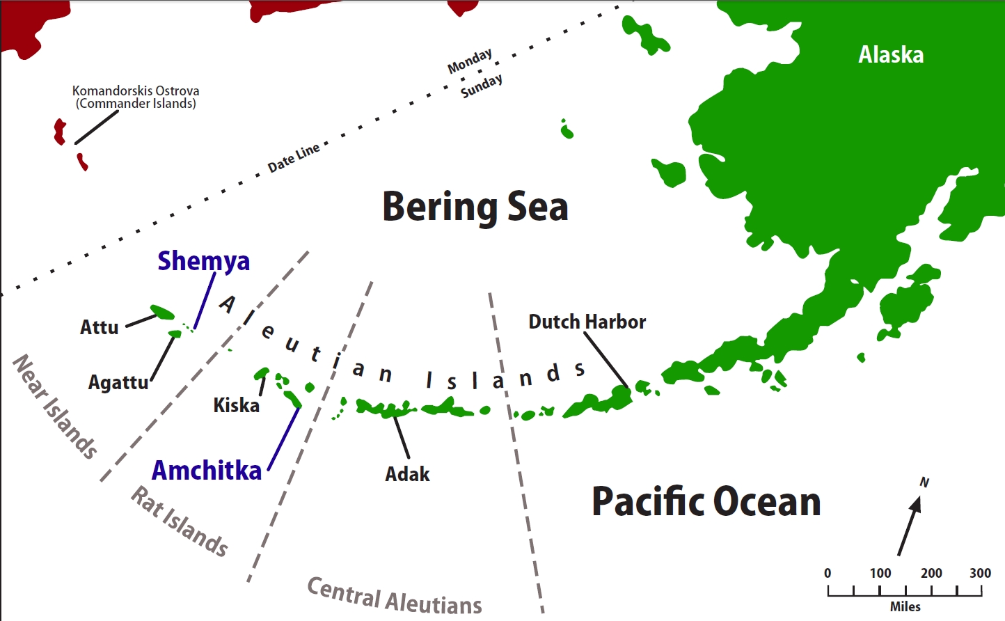
far western most island is Attu
distances in the Aleutians
ISLANDS GOING WEST TO EAST TOWARD ANCHORAGE
Beginning with Attu Island here are the next few islands

Attu Island (35 mi x 20 mi) - this is the furthest West in the United States and
last western most Aleutian Island
moving eastward along the Aleutian Island chain
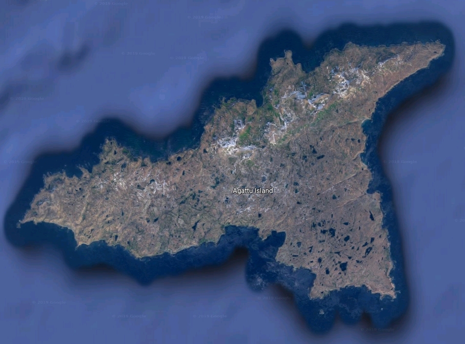
then Agattu Island
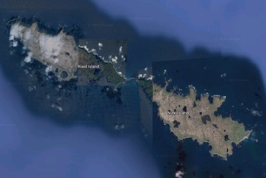
then Alaid Island & Nizki Island
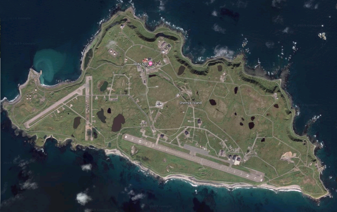
then Shemya Island
then on to Anchorage
On Attu Island
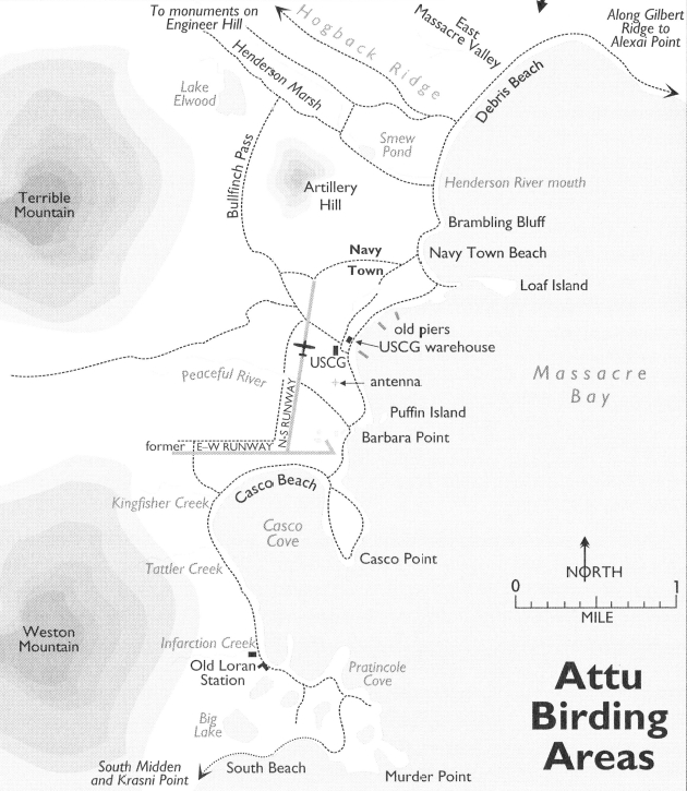
This map shows the South Eastern area of Attu Island
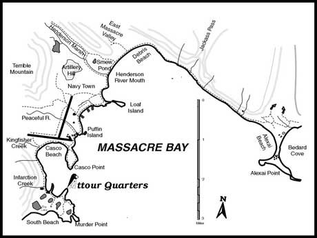
A map of Attu Island birding areas - specifically the area covered in the
following images extending from the lower left corner (base camp)
although we went further west to Temnac Valley and to
Murder Mountain areas to bird (not shown on map)
to the lower right corner (Alexai Point).
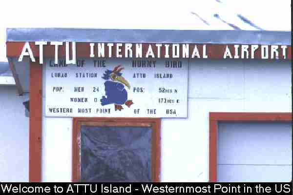
Welcome to ATTU Island - A Birder's Paradise!
This is the first thing you'll see getting off the
Reever (Reeve Aleutian Airways) aside
from the pristine beauty of the island!!

after Attu Coast Guard abandonment of the island - what it looks like
The following photos are all taken in 1990 or early 1990's on slide film
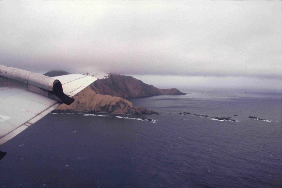
Approaching Attu Island, Alaska from the East
East end of Attu Island, Alaska
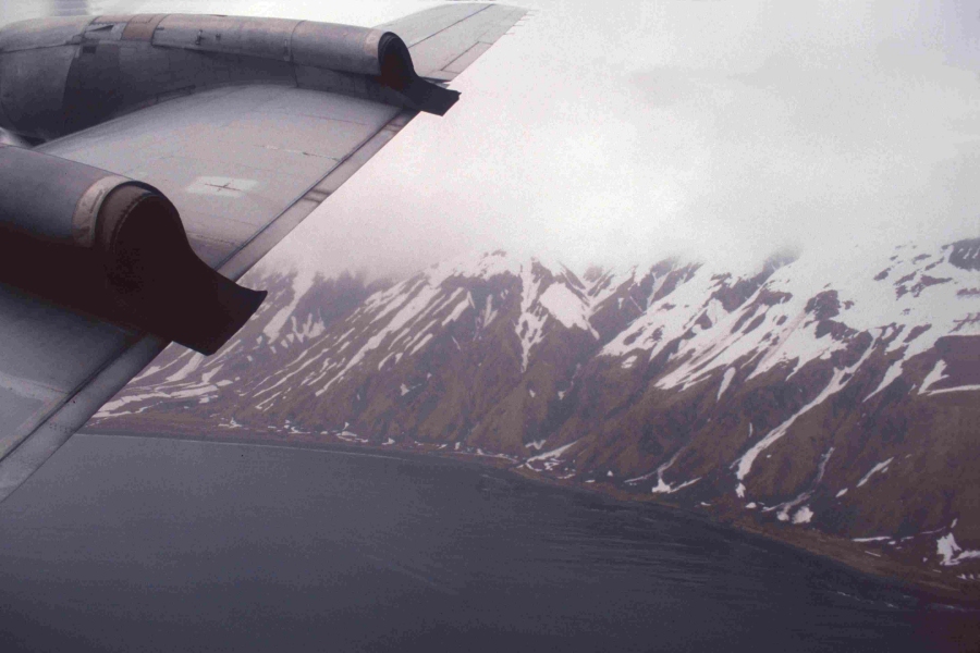
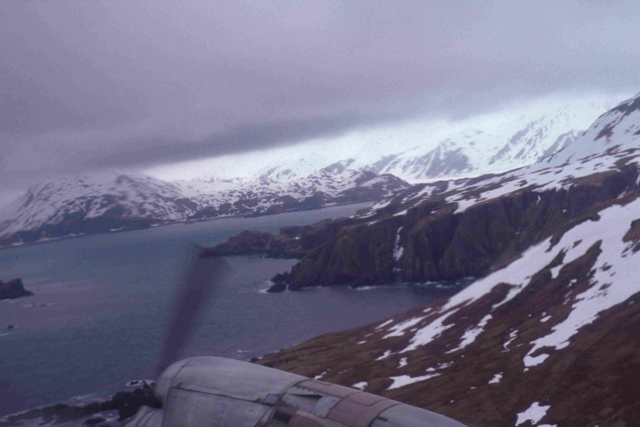
Coming by Gilbert Ridge west of Alexai Point, Attu Island, Alaska
Gilbert Ridge from Air, Attu Island, Alaska
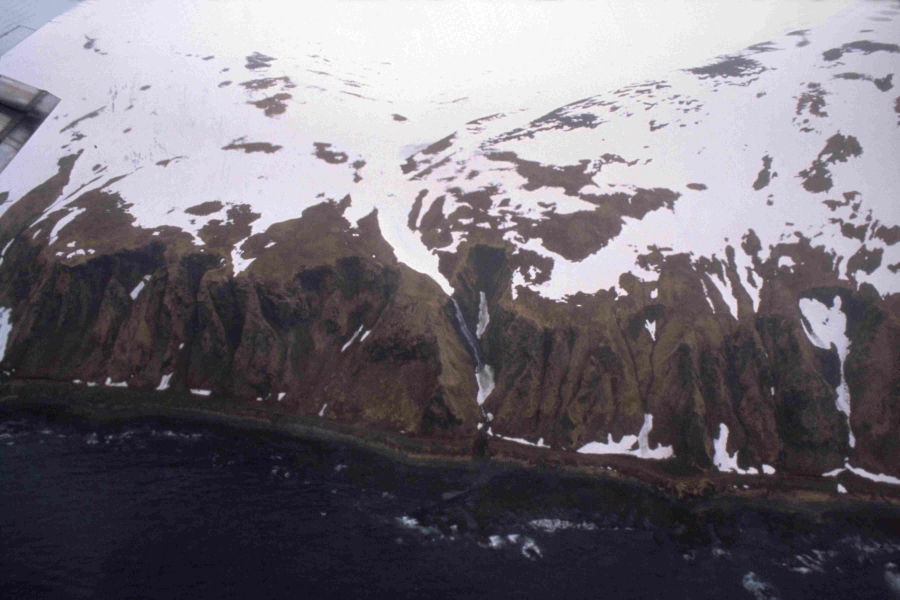
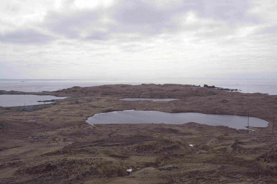
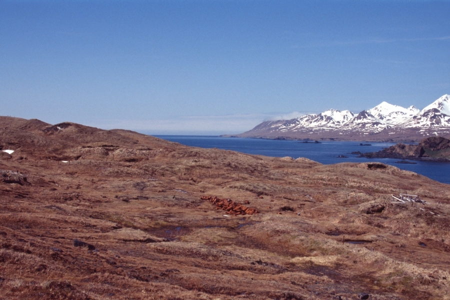
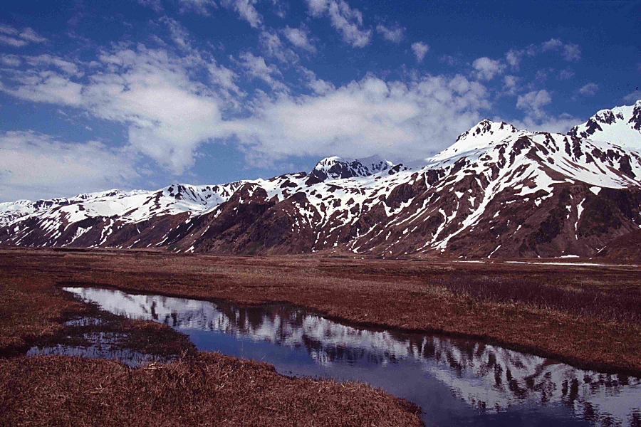
East Massacre Valley, Attu Island, Alaska
East Massacre Valley, Attu Island, Alaska
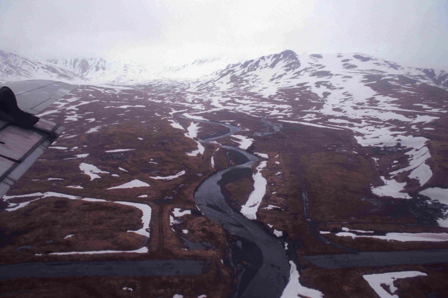
West Massacre Valley, Attu Island, Alaska
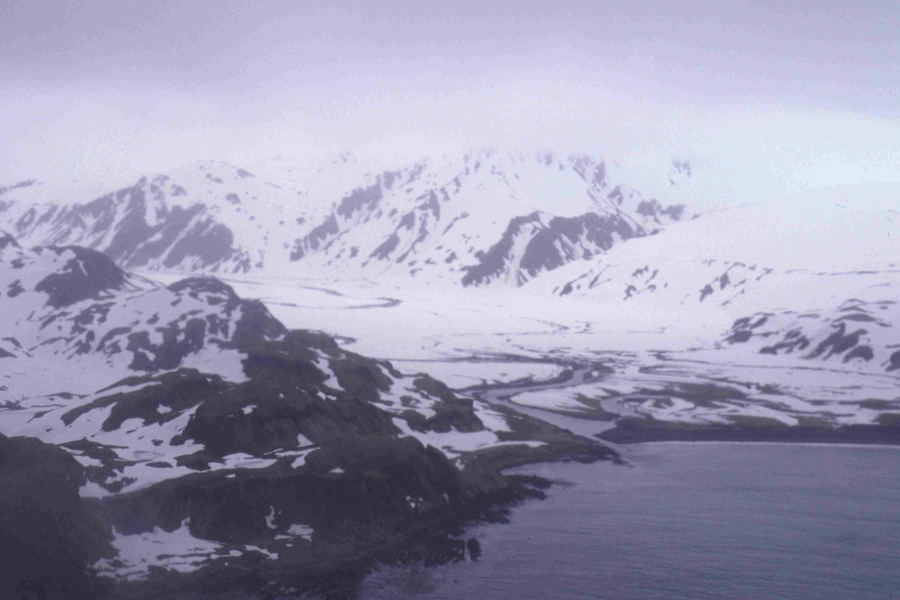
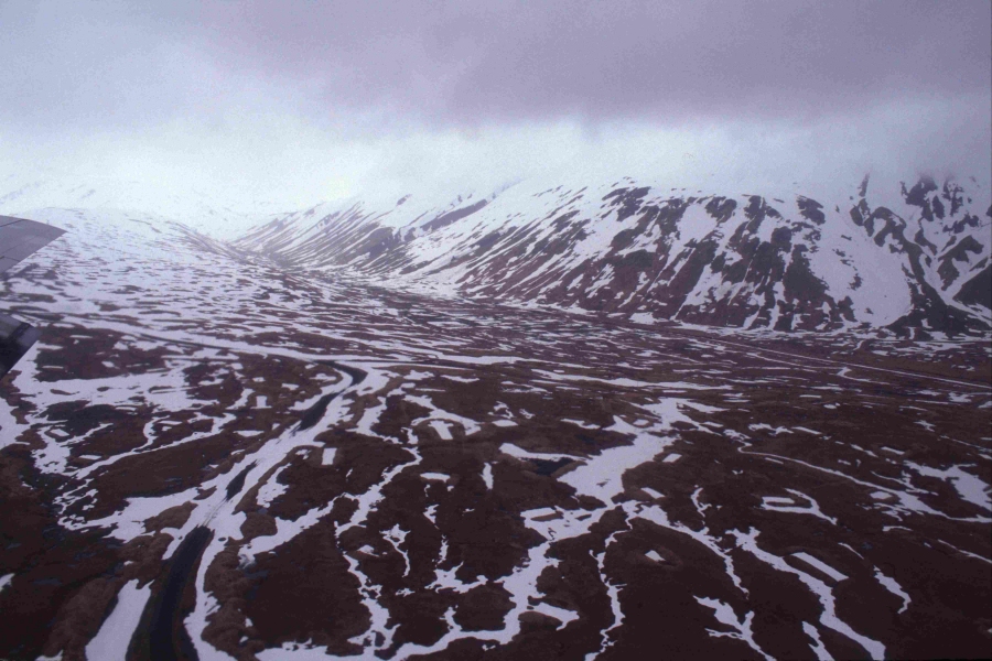
Temnac Valley from the air, Attu Island, Alaska
West of Temnac Valley, Attu Island, Alaska
West of Temnac Valley, Attu Island, Alaska
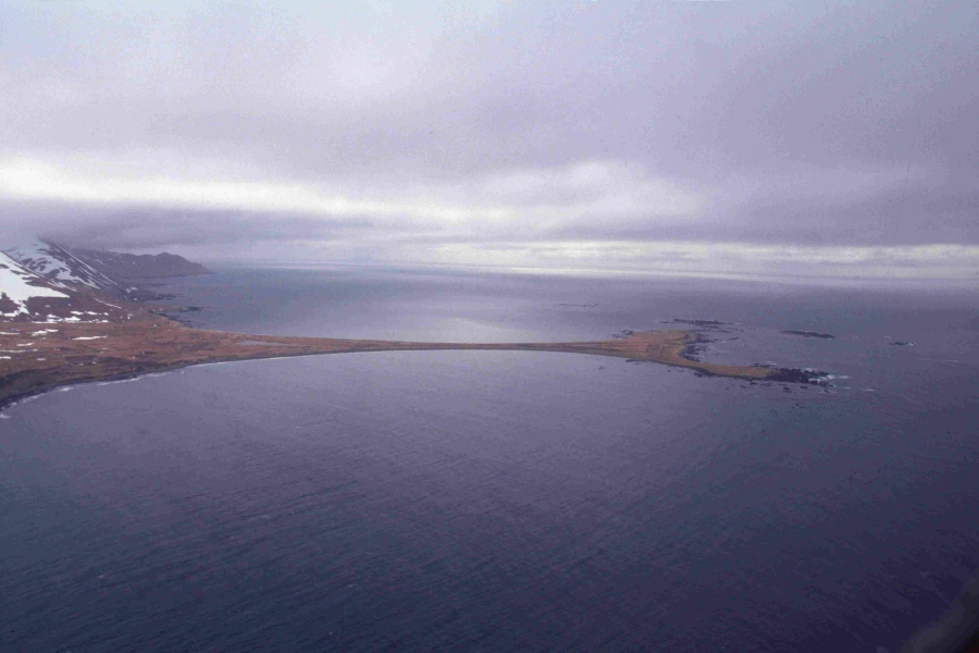
Warehouse Beach with Weston Mountain in background, Attu Island, Alaska
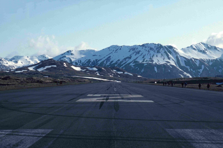
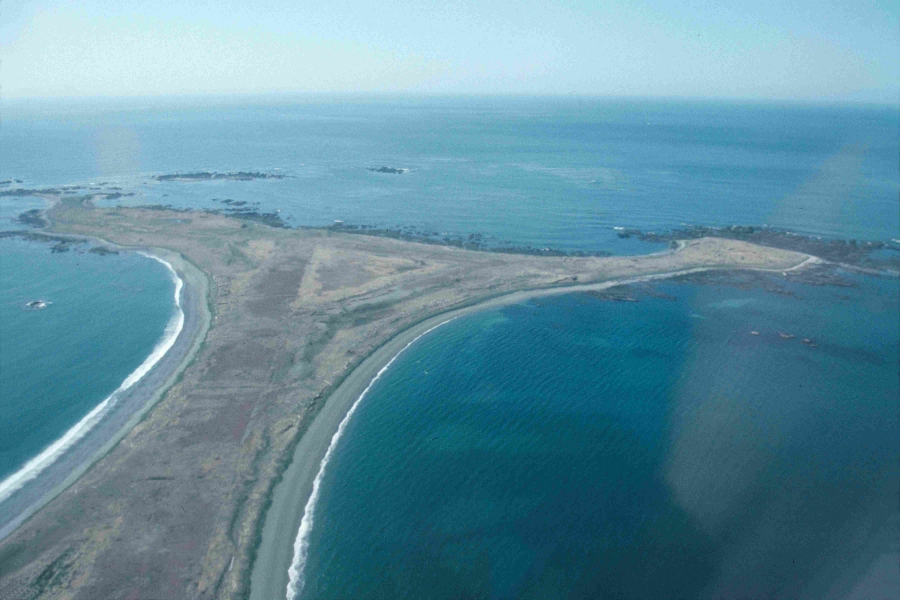
Main Runway at Attu Island, Alaska
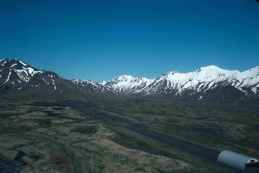
The "East-West" Runway - Attu Island, Alaska (that structure was
removed and not here in 1994)
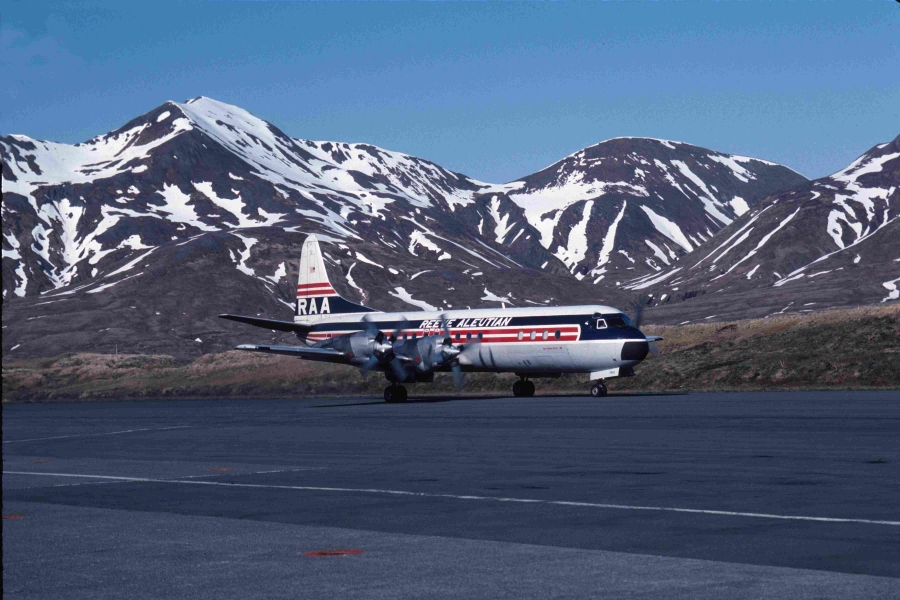
Lockheed Electra III landing at Attu Island, Alaska
our transportation to and from Attu each year for those of us who stayed the
entire 3 week period
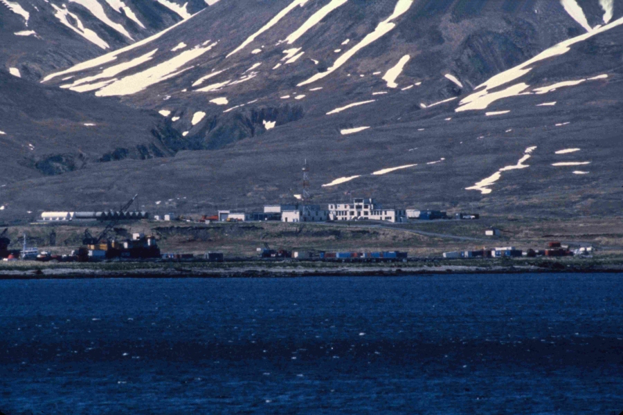
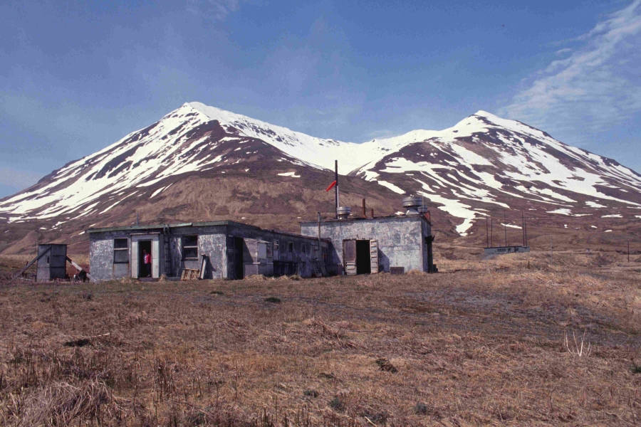
US Coast Guard Loran Station with Weston Mountain in background, Attu Island,
Alaska
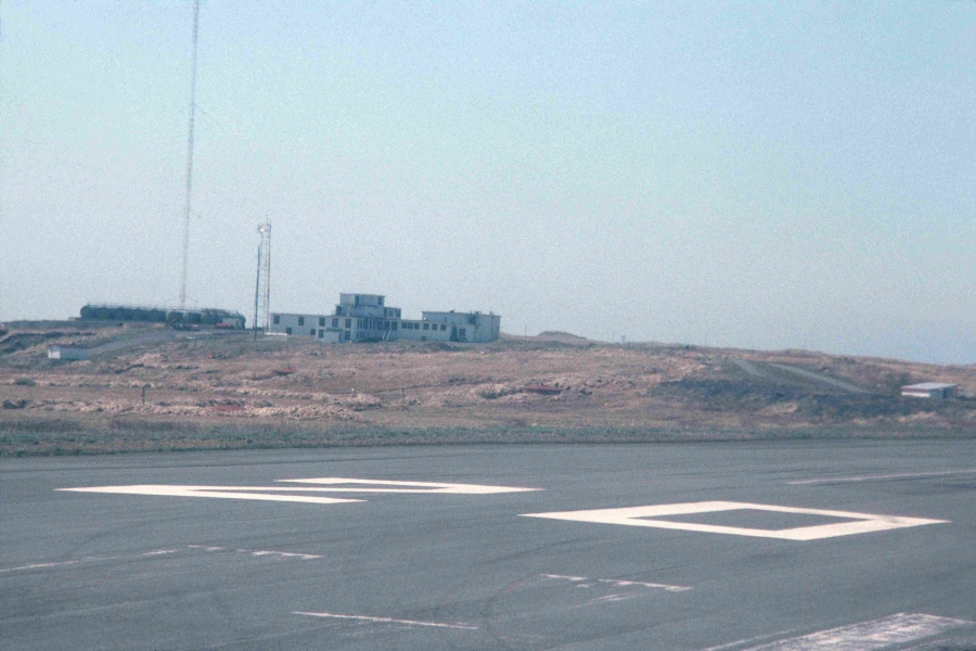
US Coast Guard Loran Station (from runway), Attu Island, Alaska
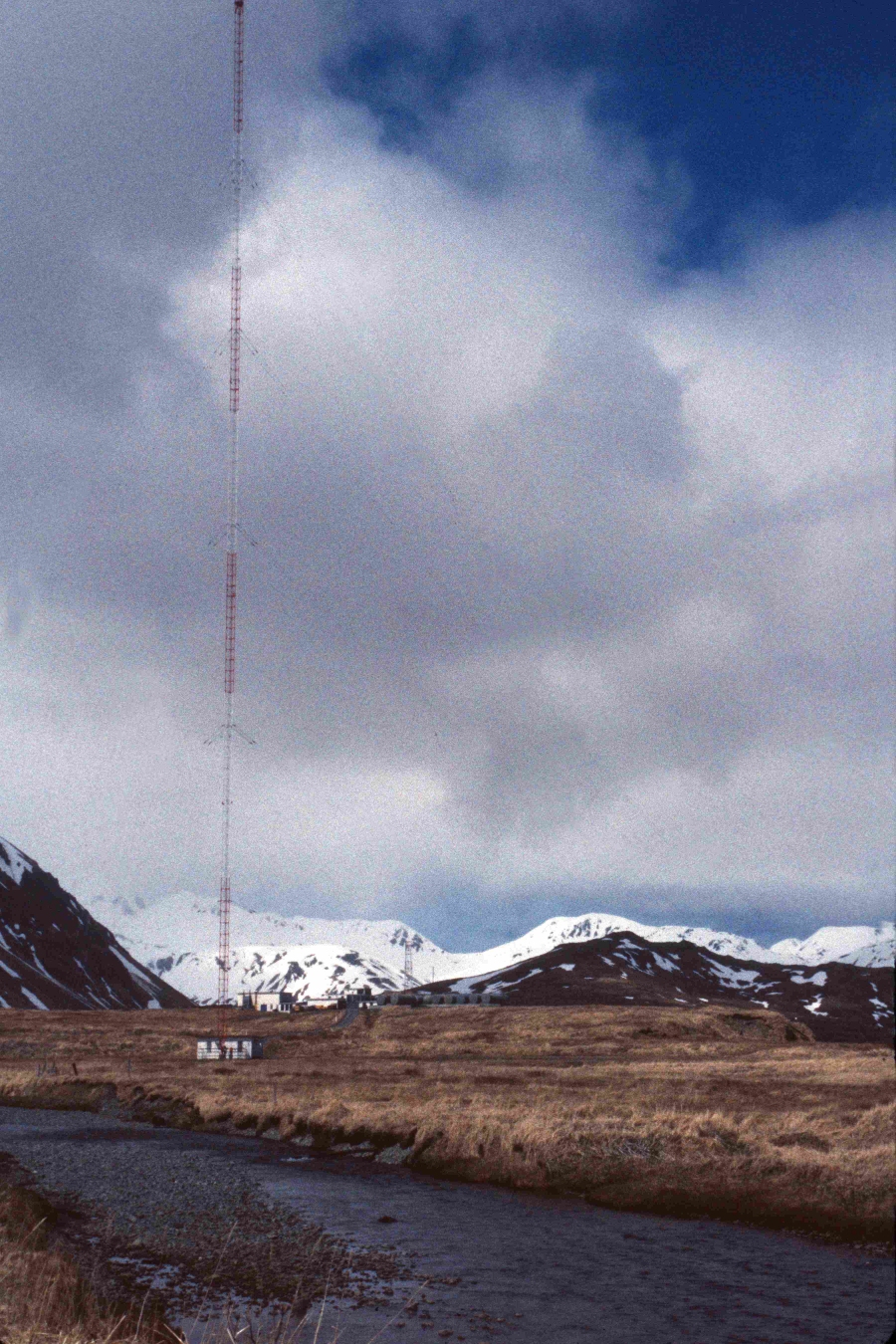
the Loran Tower at US Coast Guard Station, Attu Island, Alaska
Gilbert Ridge in background and main runway center, Attu Island, Alaska
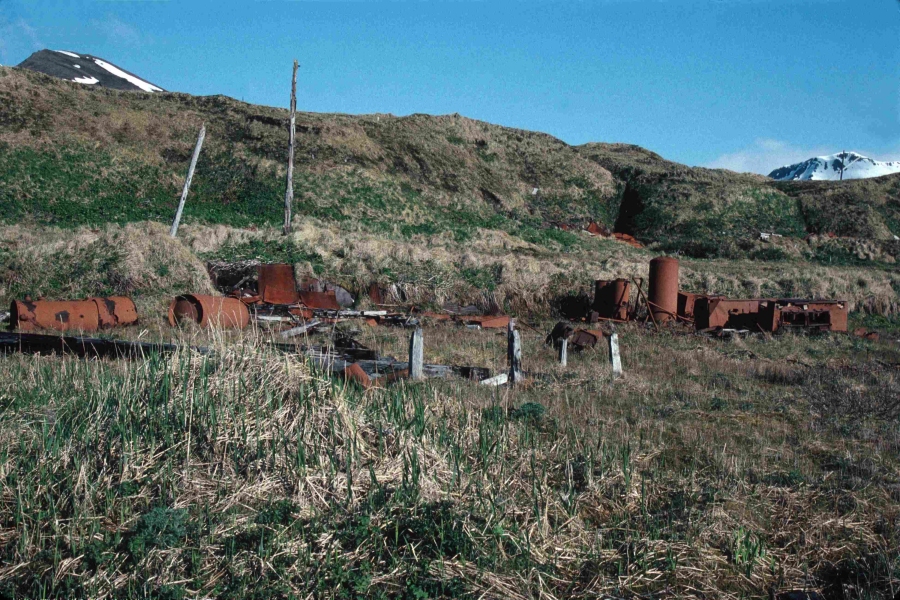
just some of the War Debris scattered around the island with some 50 gallon oil
drums still leaking, Attu Island, Alaska
Piled up Matson Mats (used for temporary runways, etc. - Attu Island, Alaska
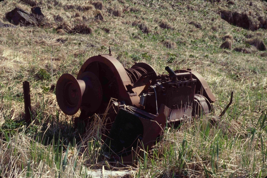
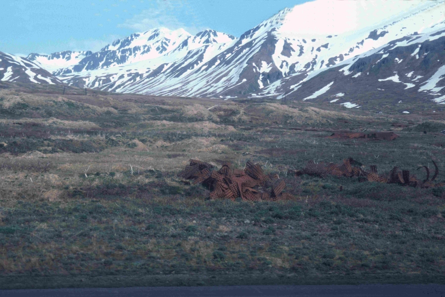
Left over war debris - Attu Island, Alaska
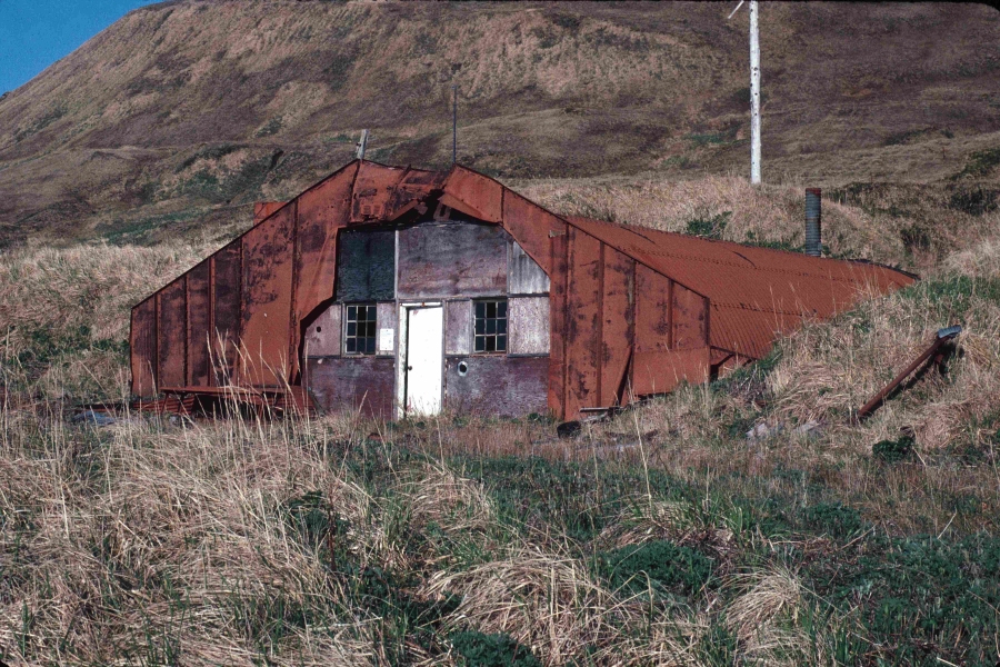
Quonset Hut - Attu Island, Alaska
Murder Point - Attu Island, Alaska

Alaid Island in the distance - Loran Station lower left - Attu Island, Alaska
Alexai Point looking east - Attu Island, Alaska
Alexai Point looking south - Attu Island, Alaska
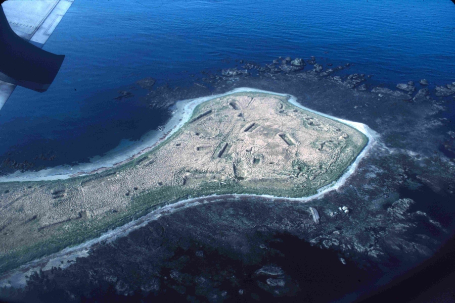
Alexai Point southwest point - Attu Island, Alaska
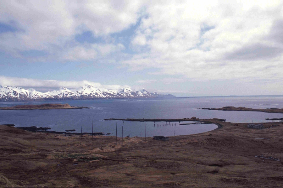
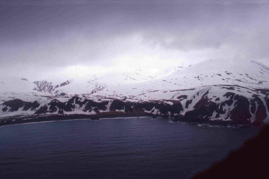
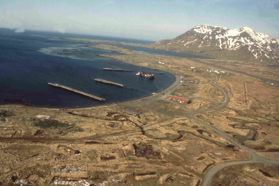
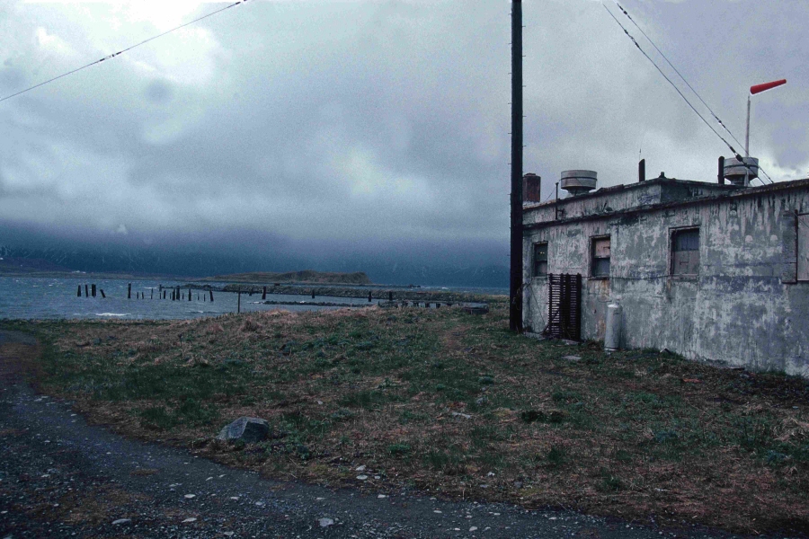
Casco Cove looking from Upper Base with Gilbert Ridge in the background - Attu
Island, Alaska

Casco Cover looking from south of Lower Base with Gilbert Ridge in the background -
Attu Island, Alaska

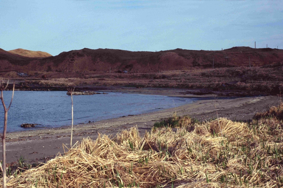
Casco Cove from south of Lower Base - Attu Island, Alaska
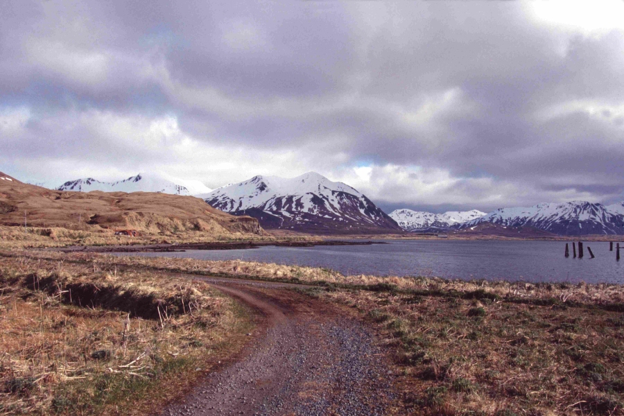
Road along Casco Cove leaving Upper Base for areas East - Attu Island, Alaska
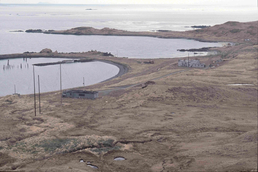
View of Casco Cove with Upper Base (left) and Lower Base (right) - Attu Island,
Alaska
taken from up on Weston Mountain
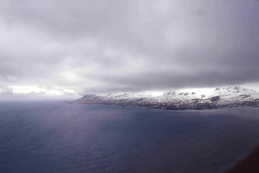
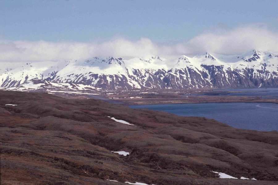
Attu Scenery - just a beautiful place (on a nice day!) with who knows what may
show up (rain, sleet, snow?) - Attu Island, Alaska
Pratincole Beach - Attu Island, Alaska
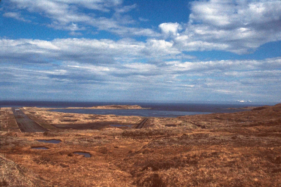
"East-West" Runway and Casco Cove in background - Attu Island, Alaska
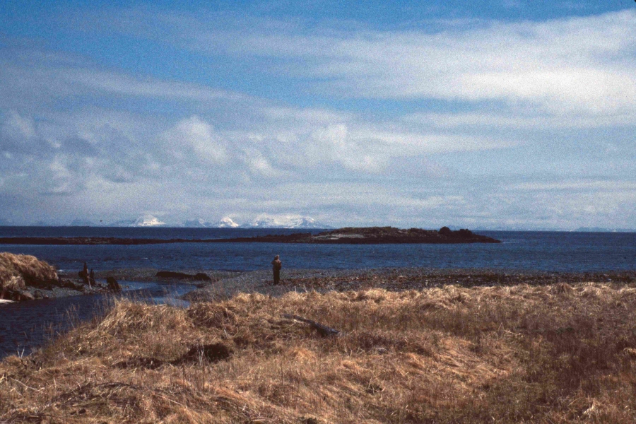
Peaceful River mouth with Agattu Island in the background - Attu Island, Alaska
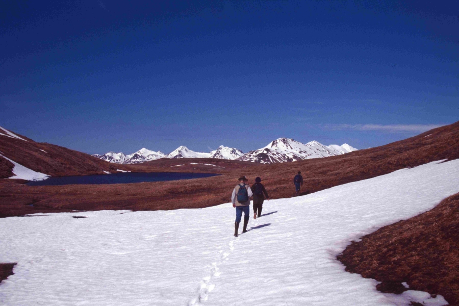
The all day trek to Temnac Valley - Attu Island, Alaska
On the way to Temnac Valley - Attu Island, Alaska
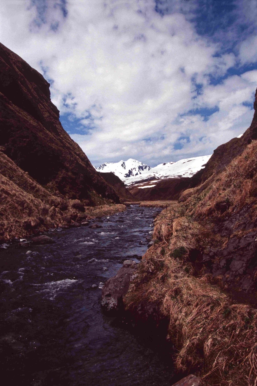
The infamous George's Creek crossing on the trek to Temnac Valley - Attu Island,
Alaska
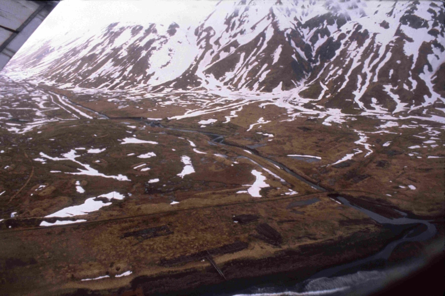
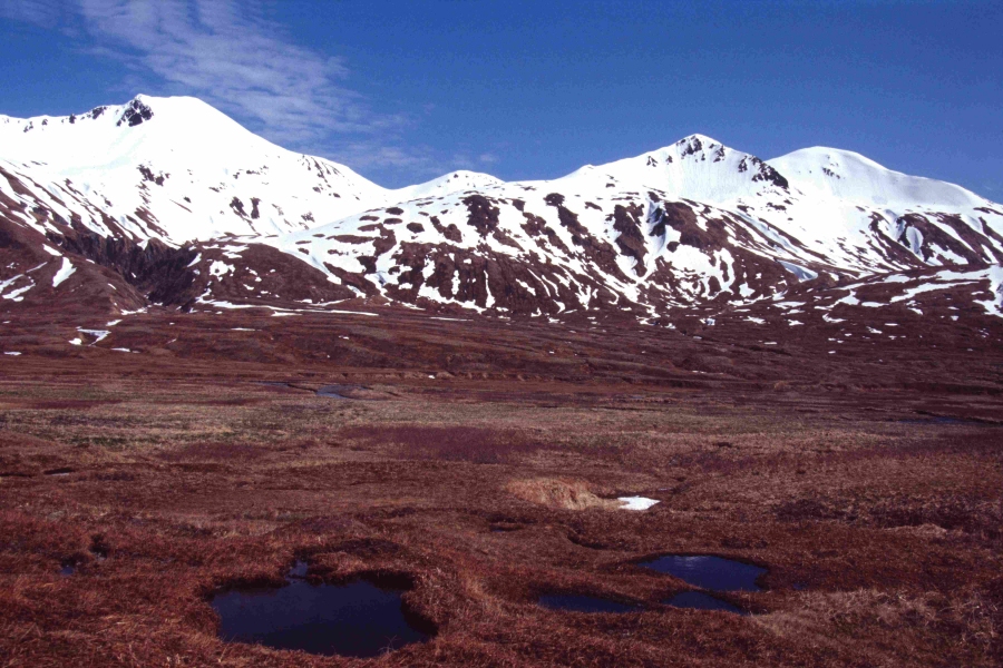
Entrance to Temnac Valley and where White-tailed Eagles loom - Attu Island,
Alaska
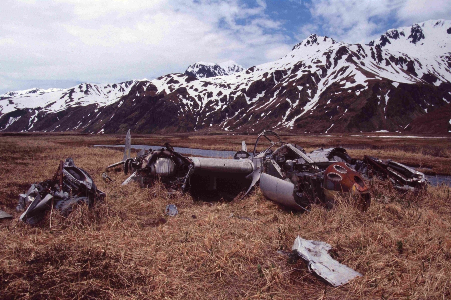
Remains of P-38 crash site in Temnac Valley - Attu Island, Alaska
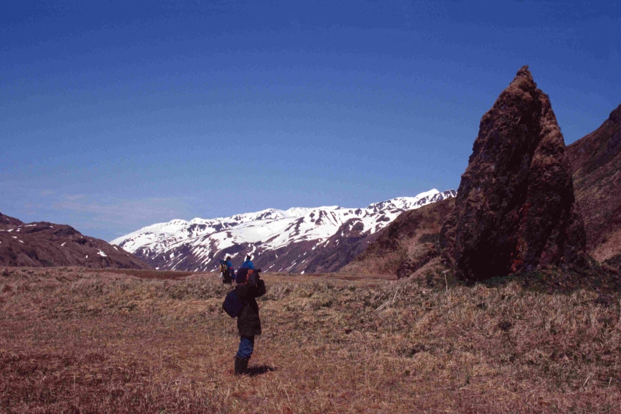
Temnac Valley (my personal favorite place on Attu) - Attu Island, Alaska
If you are up to a full day's hike over snow covered mountains
and a raging creek, the sight you behold while entering this valley
almost (I said almost!) makes you forget you came here to see the
White-tailed Eagle. To many, this is the most beautiful place on Earth.
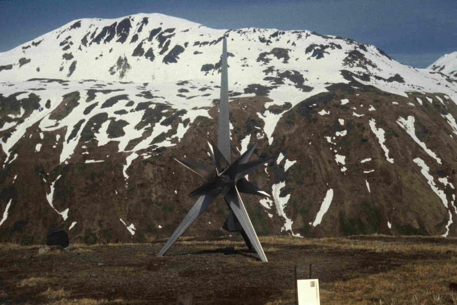
Japanese War Memorial for WWII battle fought here - Attu Island, Alaska
Lower Base sleeping quarters with the only Outhouse on the island to the left -
Attu Island, Alaska
(we nicknamed it the "Attu Hilton")
Lower Base with a storm a coming and who knows what with it - Attu Island,
Alaska
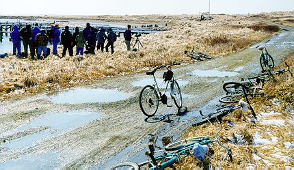
Birding by Bike - Attu Island, Alaska
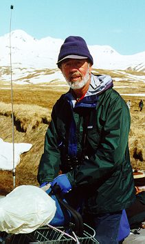
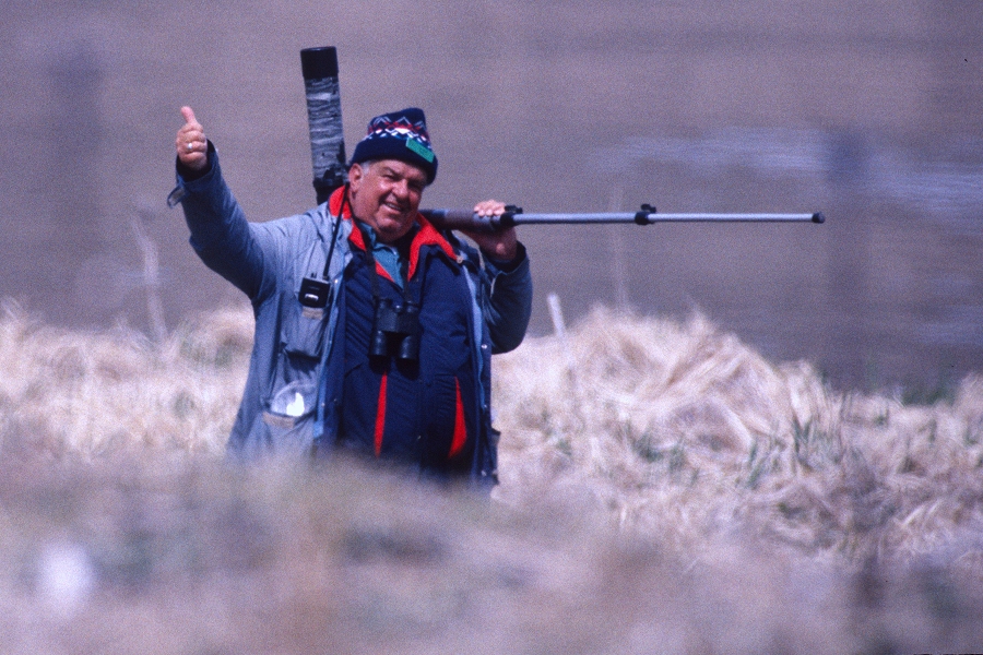
Al Driscoll - Attu Island, Alaska
Sandy Komito (left) - Attu Island, Alaska
Sandy Komito - Attu Island, Alaska
one of my very best friends who I speak to on the phone nearly monthly
and visit with nearly each time over to Florida where Sandy lives now.
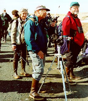
Jerry Rosenband - Attu Island, Alaska
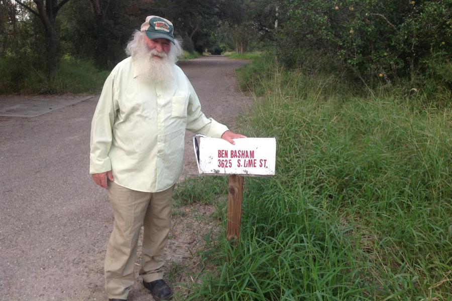
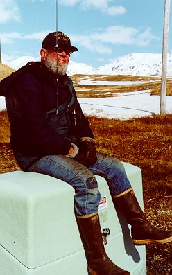
Benton Basham - years later after many trips to Attu
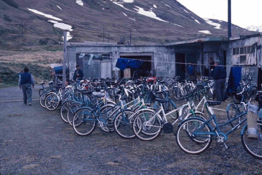
Lower Base with bicycles (in the days of 3 speed bikes - later finally
multi-speed mountain bikes), Attu Island, Alaska
-earlier actually single speed bikes-
Larry Balch standing w/ Coffee Cup near left of photo
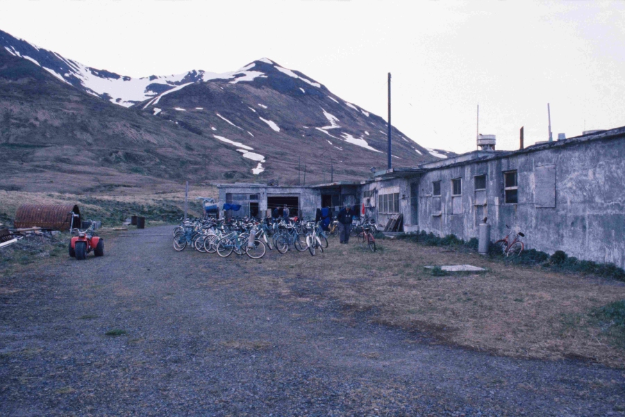
Lower Base in the days before the "Pig Heaters" which helped a great deal
providing a couple hours of heat daily, Attu Island, Alaska
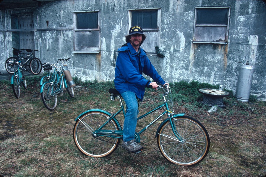
Me on my bike Attu 1991 - Attu Island, Alaska
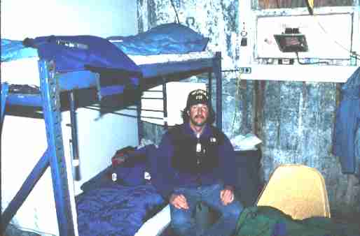
Me in my room at the Attu Hilton (Attu Island, Alaska)
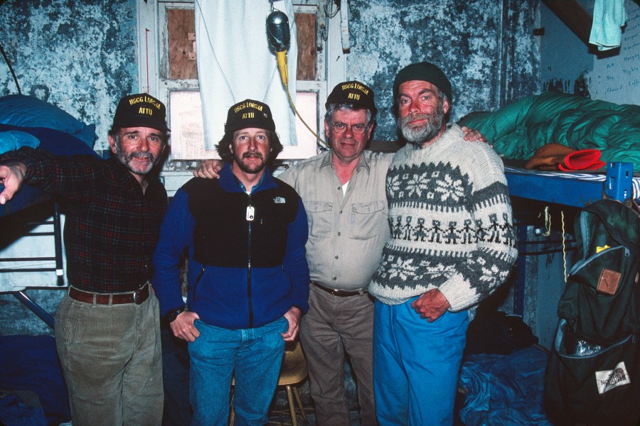
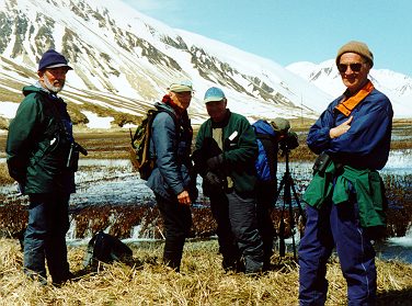
Attu, Spring 1991 - a
few years ago (Me - Second from left in Blue Jacket)
David Narins, myself, Sandy Komito (Attu Island, Alaska) - Spring 1993
BJ Rose from Sedalia, Missouri at Attu, Alaska circa early 1990's
Was #1 Photographed Bird Species in the ABA for decades
and now retired and enjoying his dog, Patches
(and my life long buddy!)
BJ passed away June 6th, 2019 and will be very sorely missed
as I feel a huge void in my life and soul now.
I will see you in heaven BJ.
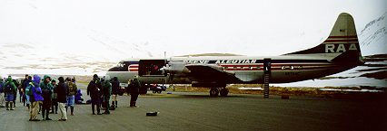
Waiting to go back to Anchorage - Attu Island, Alaska
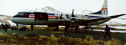
Waiting to go back to Anchorage - Attu Island, Alaska
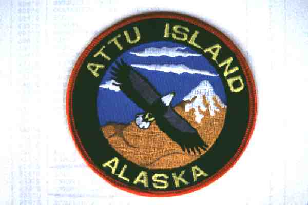
The Attu Island Patch for those who've 'experienced' (3 full weeks) the emotions / memories /
weather / birding of Attu Island, Alaska
These were REAL trips to Attu, not some boat going out and spending a few days
zodiac 'ing on and off the island each day
and not at all covering the extent of Attu that we birded on our 3 week trips
each year
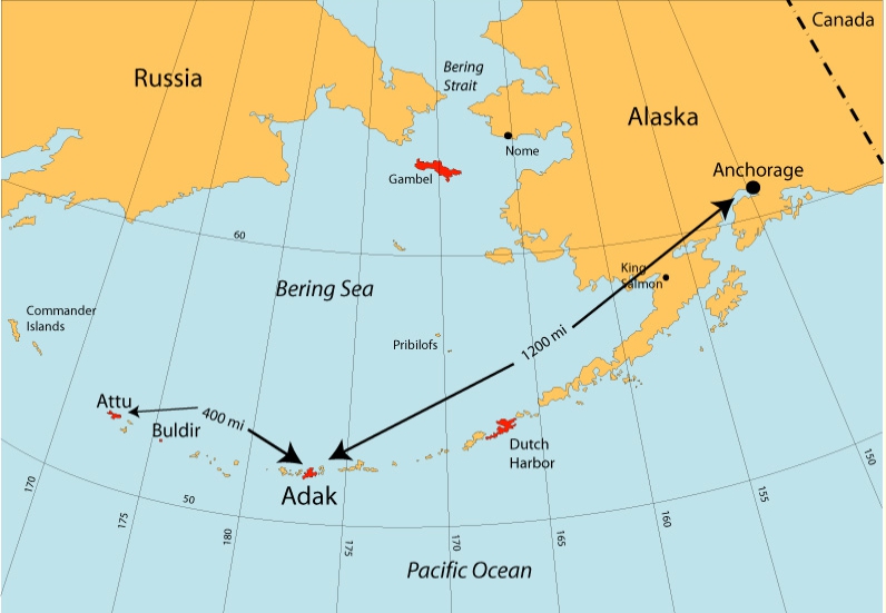
Attu Island is the most remote, most westward island in Alaska’s Aleutian chain.
Lying at 538N, 1738E, the island is situated with Anchorage, Alaska 1920 km to
the
northeast and the city of Petropavlovsk on the lower Kamchatka Peninsula of
Russia
nearly 960 km to the west. The island is 67 km long and 26 km across at its
widest
point and includes approximately 400 km2 of land area dominated by high
mountains
and largely inaccessible wilderness area. The only roads and habitation are in
the southeast corner of the island where there is a small coast guard station
and
runway and a rudimentary road system left over from an abandoned military base.
Attu Island has three major claims to fame: 1) its generally miserable weather,
2)
the bloody battle fought by U.S. troops in 1943 to recapture the island in World
War II, and 3) the remarkably rich mix of Eurasian bird species that can be
found
on the island during spring (and fall) migrations.
The story of the capture and
take-back of the Aleutian Islands of Attu and Kiska during World War II
is not well-known to most Americans, and few veterans of the fierce
three-week-long
battle on Attu in May 1943 remain to tell their stories.
The battle ended in the death of nearly 3,000 Japanese and 529 Americans.
ALL IMAGES ON THIS PAGE ARE COPYRIGHTED AND
NOT FOR USE BY ANYONE WITHOUT MY EXPRESS PERMISSION
|
HomeImage
List by Species |
- FOR AN ENLARGED VIEW SIMPLY CLICK ON EACH IMAGE -
TO RETURN, PRESS THE BACK BUTTON ON YOUR BROWSER
Copyright
©
1996-2025
Monte M. Taylor / All Rights Reserved. 36 USC 380
The Contents and Graphics were created by and copyright owned by Monte M.
Taylor and protected
by U.S. copyright laws. The Contents and Graphics may NOT be used on another
website,
for email attachments, chat sessions, clipart collections, or by any other
means, including copying or saving of digital image files, unless
otherwise expressly written permission was granted by me.